
Big jobs on a laptop
Alignment splits large surveys into blocks that share one camera, then joins them into one model. At Batman the steps at the joins measured +0.1 and −0.2 cm.

FieldMosaic turns your DJI survey photos into an orthomosaic, DSM, DTM and quality report on an M5 MacBook. Every height is checked against the drone's laser and your Emlid survey points.
Designed and tested on the entry 16 GB M5 MacBook. By Gardner Avionics.
These come from client surveys flown with a DJI Matrice 4E and processed in FieldMosaic on a 16 GB M5 MacBook.
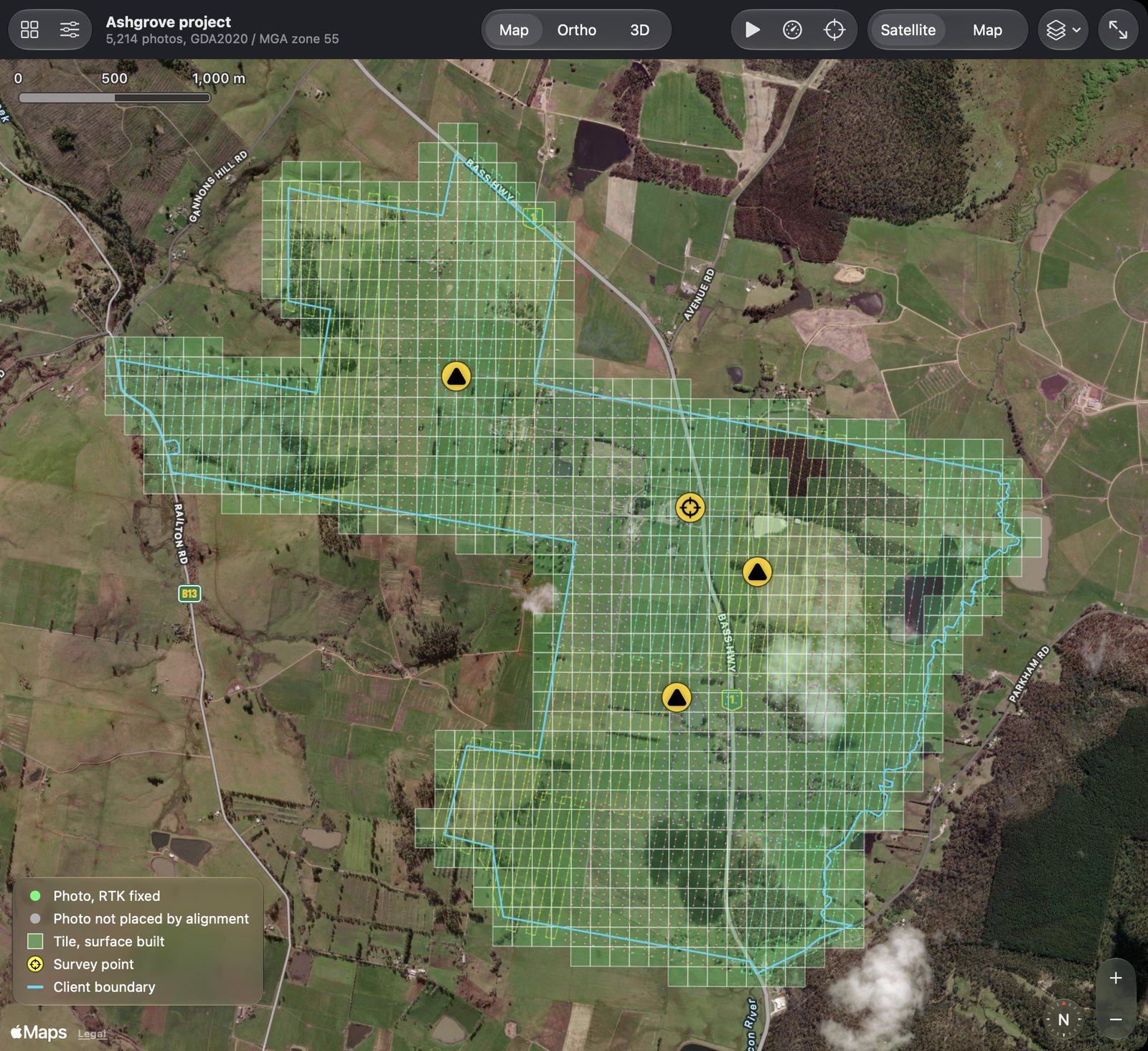
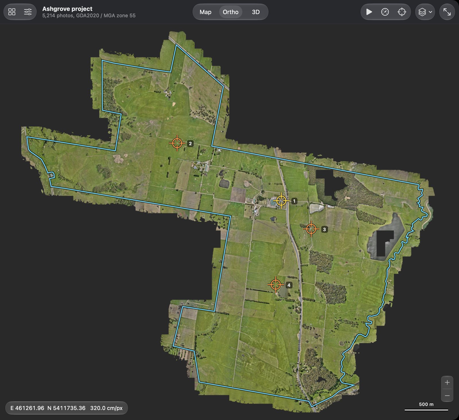
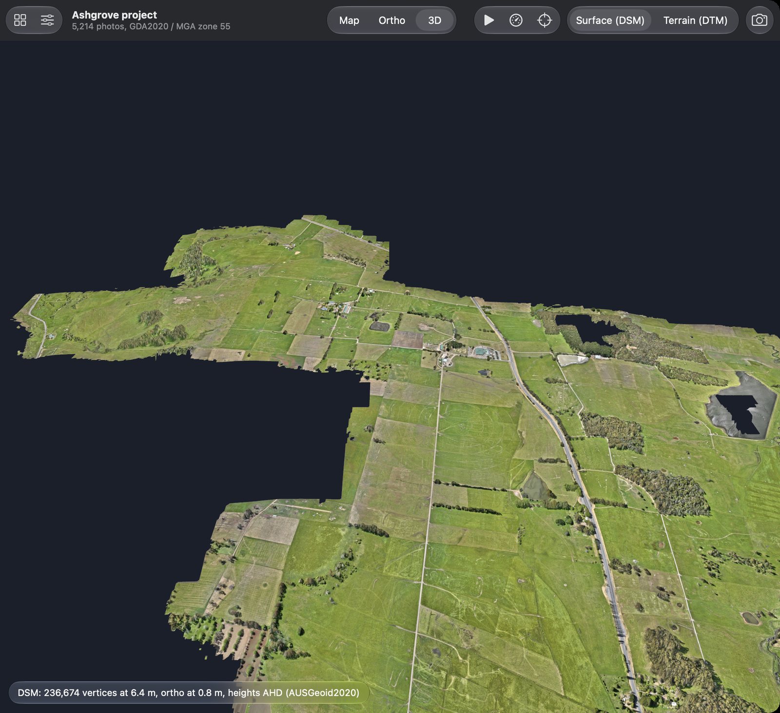
16 flights at Ashgrove, processed in one project
a 4.7 by 4.3 km site, 5,149 photos placed
under half of the MacBook's 16 GB
Ashgrove survey points, each left out in turn
Most photogrammetry is built for a Windows workstation with a big NVIDIA card. FieldMosaic is built for the Mac you already carry, so the job can be processed in the ute, at the motel or back at the office on the same laptop.
A Swift app and engine written for Apple Silicon. Nothing to emulate, no Windows partition, no dedicated graphics card.
Every heavy stage is designed around the 16 GB of the entry M5 MacBook. Large surveys are aligned in blocks that share one camera calibration, so a 5,000-photo job still fits.
All processing happens on the Mac. No uploading 50 GB of photos over a site connection, no waiting in a cloud queue, no client data on someone else's server.
One app takes the job from the drone's SD card to the files your client asked for, with the checks that tell you they are right.
Alignment splits large surveys into blocks that share one camera, then joins them into one model. At Batman the steps at the joins measured +0.1 and −0.2 cm.
The Matrice 4E's laser return under every photo is compared with the solved ground, flight by flight. It also corrects the camera's focal length, the hidden cause of height errors on nadir RTK flights.
Camera positions, RTK fix status, gimbal angles and the laser return come out of the photo metadata, and the MRK file adds exact exposure times. No position file to export.
Load your Emlid Flow CSV of GCPs and check points. Each point gets a residual in the report and a photo chip of its target, so you can see what you measured.
Fetch the RS2+ base log straight from the receiver over Wi-Fi. FieldMosaic reads the base's own track and flags any moment it moved, and the photos taken after.
A sheet shows each target in every photo that sees it, with its predicted position. Marking one point across 10 photos takes about a minute.
Optional post-processed camera positions with RTKLIB against your Reach base log or a CORS station, with every photo checked against its RTK position.
An A4 PDF with check point residuals, the laser check, coordinate systems, camera positions against RTK, the base station and a coloured overview of the site.
Cloud optimised GeoTIFFs with overviews, ready for QGIS, ArcGIS and web maps. The DTM comes from ground classification of the surface.
Outputs on GDA2020 / MGA with AHD heights through the bundled AUSGeoid2020 grid, or WGS 84 / UTM with EGM2008 heights outside Australia.
Ortho, surface and terrain views with a height readout under the pointer, and a 3D view with the ortho draped over the ground. A live map fills in tile by tile while it runs.
If the Mac sleeps, you stop the run or an external drive drops out, Resume Processing carries on from where it left off instead of starting again.
The ortho, DSM, DTM and PDF go straight to the job folder you choose. The gigabytes of working data stay in the project, out of the way.
CPU, memory, temperatures and fans while the job runs, so a busy Mac is easy to tell from a stuck one on a long job.
The Matrice 4E fires a laser rangefinder at the ground for every photo. FieldMosaic uses thousands of those returns as an independent check on the surface, so a height error shows up in the report instead of in your client's earthworks.
Nadir RTK flights pin the camera positions but leave the focal length weak, and at 65 m a 1 % focal error is 65 cm of height. Alignment rescales the focal length from the laser and adjusts again.
The report gives the laser residual for every flight, so one flight sitting high or low is easy to spot.
Rings from the centre of the site show doming, and height groups compare flights flown at different heights.
The height error the laser caught on the first Batman solve. Reprojection error, camera residuals and the comparison with another package had all missed it.
No processing templates to tune, no stage-by-stage babysitting. FieldMosaic runs every stage in order and tells you what it is doing.
One button runs the whole job, and the system workload window shows it is still working when you come back.
The job starts the moment the photos are on the drive, not after hours of upload on a site connection.
At Charlotte the base blew over in the wind mid-flight. The base log check found the 23 photos taken after it moved, before they could spoil the job.
When an external drive dropped out halfway through a 956 ha job, Resume Processing carried on from the tiles already done.
FieldMosaic reads the files your drone and receivers already write. There is no format conversion and no export step between the field and the office.
RTK positions and fix status, gimbal angles, the laser rangefinder and the MRK exposure file, all read directly. The Matrice 4E is the drone it is tested on, and photos from other drones load from their GPS position.
Fetch the base log over Wi-Fi, check the base did not move, and use it for PPK if you want post-processed positions.
Load the GCPs and check points you collected in Emlid Flow, on GDA2020 / MGA with AHD heights, straight from the CSV.
FieldMosaic costs a lot less than most of the photogrammetry packages it competes with, and it saves on the hardware and services around them too.
Priced well below most of the big photogrammetry suites, for the jobs most drone surveyors actually fly.
No Windows PC with a high-end graphics card. The entry 16 GB M5 MacBook is the machine it was designed on.
Processing is on your Mac, so there is nothing to pay per hectare or per photo, and nothing to upload.
FieldMosaic is made by Gardner Avionics, Kyle Gardner's company. Kyle flies drone surveys for clients in Tasmania and processes them with FieldMosaic. Every feature is tested on those real jobs, against surveyed points and the drone's laser, before it ships.
These are on the roadmap. None of them is part of the product today.
Download and update FieldMosaic from the Mac App Store.
Camera profiles and testing beyond the Matrice 4E.
Transformations between datums and more national grids.
Map the columns of survey point files the app cannot read on its own.

Be first to hear when FieldMosaic opens to other surveyors.
Register your interest